Introduction
Ecologically, Taarsh is a world of islands. Originally, the planet was a water world, dotted with small continents, archipelagos, and island chains. Now, after centuries of dumping, these landmasses have grown and interconnected. However, even on these landmasses, vast deserts of crushed bottles or broken glass can divided habitable regions from one another - forming islands within seas of trash.
My goal for this post is to create a tool by which the various garbage 'islands' of Taarsh can be generated - copying the region generation system presented by Signs in the Wilderness. SitW's chart works by presenting a single 'typical' biome - in their case the forests of Eastern North America - and then presenting a table of features which differentiate the region from that default. In terms of statistics, SitW's table present six different categories of features which can be rolled - topographic features (25%), rivers (25%), difficult terrain (15%), open terrain (10%), coastlines - which includes islands (20%), and finally natural wonders (5%). The fact that one is meant to roll three features for each region complicates these odds - there is a chance, for example, that a region has three different kinds of rivers. Rerolls and creative thinking mitigate these problems in practice.
Creating my Charts
In creating my own charts for each waste biome typical of Taarsh I have simplified this system. Instead of six feature categories, I relied on only 4 - each having a 25% chance of being rolled. For example, I combined the rough and open terrain categories into a generic 'different terrain' one, which allowed flexibility in regions where the default terrain is already extremely open - such as glass of plastic flats. I also did away with wonders entirely by expanding the coast category. I did this for three reasons: 1. Taarsh is a water world with many coastlines and islands, 2. most natural landmarks are buried under garbage, 3. human made landmarks will be generated separately from regions.
Generating Regions
In order to generate a description of a region, simply choose which biome you want or roll a die. The table I intend to use is below. This system results in a 25% chance of getting an environment more or less the same as earth (bone heath), and a 50% chance of a region with significant plant life (bone heath, garbage heaps, and clothes heaps). The other types - paper, plastic, glass, and scrap - act as desert 'lakes' and 'oceans', splitting areas of life apart from each others.
D8 - Result
1-2 - Bone Heath
3 - Garbage Heaps
4 - Clothes Heaps
5 - Paper Heaps
6 - Plastic Flats
7 - Glass Flats
8 - Scrap Heaps
Once a region type has been selected, simply roll three times on its corresponding d20 chart to determine its features.
Bone Heath
Description: areas where organic waste is dumped, often after weeks of decomposing on their home planet or during transit. This forms a nutrient rich soil mixed with bone fragments and occasional waste wrappings (typically plastic) on which vegetation can easily grow. The default terrain is savannah - grass or shrubland dotted with clumps of trees. Trees also often line lake edges or riverbanks.
Roll | Feature | Additional Information |
1-2 | A series of parallel ridges run in a similar direction across the region. | The range/cliffs run (d4): 1. North-South, 2. Northwest-Southeast, 3. West-East, Northeast-Southwest. |
3-4 | A towering mountain range runs through the heart, or along one side of the region. There are few safe passes across the heights. |
5 | A rocky escarpment or steep slope divides the region in two - waterfalls run down from the higher side over this towering ledge to the other. |
6-7 | Thick rainforest of towering trees. Buttress-roots and hanging lianas block travel. |
|
8 | Arid where the cracked earth is carpeted with wavy mushrooms and scattered with scrublands. |
9 | Arid plain carpeted with grass that towers over human height, blocking vision. |
10 | Large flooded plain choked with reeds and dotted with trees. |
11 | Broad and slow meandering river with many oxbow lakes - splits into a vast, swamp delta if near a coast. | Water flows down to the coast or (d8): 1. North, 2. Northeast, 3. East, 4. Southeast, 5. South, 6. Southwest, 7. West, 8. Northwest. |
12 | One great river flows down from deep inland toward the sea, fed by several streams as it goes. |
13 | Many parallel streams join together as they wind their way out of the region. |
14-15 | In general, the terrain is drier than usual. River valleys or gullies, empty of water most of the year spring into life during rainstorms. Here and there may be stagnant pools where salt or chemicals collect. |
16-17 | Thin sandy or muddy barrier islands create a lagoon between the ocean and the main coast. Brackish mangroves extend deep inland beyond. | A sea or vast lake lies to the (d10): 1. North, 2. Northeast, 3. East, 4. Southeast, 5. South, 6. Southwest, 7. West, 8. Northwest, 9-10. The region is an island or chain of islands. |
18 | A gradual, mucky beach dips off into a long shallow choked with crinoids and seaweed that strangles boats attempting to land. The shore is inundated and boggy. |
19-20 | A broad sandy beach with sandbars or patches of floating garbage blocking inlets and river mouths. |
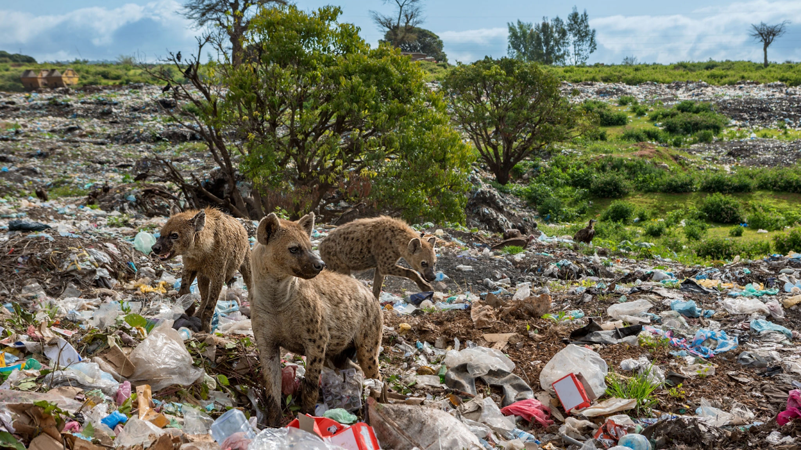
Garbage Heaps
Description: areas where various types of waste are dumped - food scraps, low paper, wrappers, plastic bottles, card boxes, and all sorts of broken junk. This garbage tends to form into rolling hills of reeking trash, overgrown in places with grasses and shrubs forming a sort of shrubland.

Roll | Feature | Additional Information |
1-3 | A series of parallel ridges run in a similar direction across the region. | The range/cliffs run (d4): 1. North-South, 2. Northwest-Southeast, 3. West-East, Northeast-Southwest. |
4 | A towering mountain range runs through the heart, or along one side of the region. There are few safe passes across the heights. |
5 | A rocky escarpment or steep slope divides the region in two - waterfalls or steep gullies run down from the higher side over this towering ledge to the other. |
6 | This relatively flat region collects water across its surface, flooding during rainstorms. The water-logged ground is home to reeds or stunted trees, which cover the region. |
|
7 | Large frameworks from massive machines or off-world construction projects lay tumbled together like a great red jungle gym of twisted beams and wires. Far below, the smaller garbage forms more solid ground. |
8 | More frequent rains and good drainage has allowed life to spring up across the region. Most of the garbage is covered in grasses or small fungus and wherever water can be found trees grow in copses. |
9-10 | The ground here is drier than most, the arid plants which typically dot this region are nowhere to be seen. |
11-12 | Throughout the region surface water is scarce. Animals moving through the landscape depend on the small pools of stagnant water that form in plastic depressions after showers. | Water flows down to the coast or (d8): 1. North, 2. Northeast, 3. East, 4. Southeast, 5. South, 6. Southwest, 7. West, 8. Northwest. |
13 | Great depressions of plastic and similar non-porous material create sorts of oases of stagnant water here and there among the rolling hills of trash. |
14 | The garbage heaps form long, dry, gullies. Though typically empty, during heavy rains these gullies flood with shocking violence. |
15 | Water pools here and there in low lying areas, transforming the surrounding garbage wastes into floodplains during heavy storms. Salt and other chemicals form along the edges of these pools, threatening life. |
16 | Waves beat against steep slopes or cliffs of piled trash. Landings are threatened by projecting metal frames. | A sea or vast lake lies to the (d10): 1. North, 2. Northeast, 3. East, 4. Southeast, 5. South, 6. Southwest, 7. West, 8. Northwest, 9-10. The region is an island or chain of islands. |
17-18 | A relatively safe and inviting beachfront hides a multitude of scrap metal blades or spikes which hide just beneath the water's surface. Boats sailing here are at risk of being holed. |
19 | The shallow shore along the coast is packed with floating bottles which form a false coastline. These packed bottles block ships, but those trying to walk atop them find themselves sinking below. |
20 | Heaps of garbage form barrier islands along a mangrove coast. The ocean between is a false ground of floating plastic waste |
Clothes Heaps
Description: dumping places for clothing - those made of synthetic materials last long here, as do metal or plastic accessories such as sequins. The typical landforms are low mounds, flattened by rain and waterlogged resulting in a profusion of aquatic plants - reeds, fungus, small shrubs - in the lowest lying areas. Heights remain relatively dry and plant free, though crusts of

Roll | Feature | Additional Information |
1-3 | A series of parallel ridges run in a similar direction across the region. | The range/cliffs run (d4): 1. North-South, 2. Northwest-Southeast, 3. West-East, Northeast-Southwest. |
4 | A towering mountain range runs through the heart, or along one side of the region. There are few safe passes across the heights. |
5 | A steep slope of piled clothing divides the region in two - waterfalls or deep swampy valleys run down from the higher side over this towering ledge to the other. |
6-7 | A stunted forest covers the region, their gangly roots branch out across the ground. The interwoven and low-hanging branches make travel difficult for off-worlders. |
|
8 | The ground is unusually flat and regularly inundated. A fungal crust forms along the surface, hiding a bog of rotten fabric below. Those who trust the crust with their weight find themselves up to their waist or deeper in the foul slime. |
9-10 | The region is unusually dry. Clothing here struggles to break down and plants are given little opportunity to find purchase. Mounds of mummified clothing are common. |
11-12 | Broad and slow meandering river with many oxbow lakes - splits into a vast, swamp delta if near a coast. | Water flows down to the coast or (d8): 1. North, 2. Northeast, 3. East, 4. Southeast, 5. South, 6. Southwest, 7. West, 8. Northwest. |
13 | One great river flows down from deep inland toward the sea, fed by several streams as it goes. |
14-15 | Many parallel streams join together as they wind their way out of the region. |
16-17 | Mounds of clothing, slick with mold, are piled steeply along the coast, breaking only occasionally where water rushes downward into the sea. | A sea or vast lake lies to the (d10): 1. North, 2. Northeast, 3. East, 4. Southeast, 5. South, 6. Southwest, 7. West, 8. Northwest, 9-10. The region is an island or chain of islands. |
18-19 | Mangrove trees grow out past the coastline into the water, forming a shallow brine-bog clogged with twisted roots. |
20 | Sun-bleached barrier islands made mostly of collected synthetics protect a long flat of clothes so moldy they turned into mud. Reeds or finger-like fungus grow everywhere, hiding the muck. |
Paper Heaps
Description: water-warped 'badlands' formed from stacks and piles of loose papers. In low lying areas the paper becomes waterlogged and turns into fungal bogs with small finger fungus or surface crusts.

Roll | Feature | Additional Information |
1-2 | A series of parallel ridges run in a similar direction across the region. | The range/cliffs run (d4): 1. North-South, 2. Northwest-Southeast, 3. West-East, Northeast-Southwest. |
3 | A towering mountain range runs through the heart, or along one side of the region. There are few safe passes across the heights. |
4 | The region is covered in towering mesas and plateaus formed from stacks of paper compressed into cubes. The edges of these are worn down with rain and time, collapsing in places |
5 | A steep slope of piled clothing divides the region in two - gullies or deep swampy valleys run down from the higher side over this towering ledge to the other. |
6 | A layer of shredded paper, in some places meters thick, lays across much of the region, accumulating in depressions. Walking across this impossible, with characters slipping down to harder ground below. |
|
7-8 | An unusually wet region. Fungal swamps and gnarled trees covers everything, broken here and there by paper mache islands that rise above the muck. |
9 | Large patches of flat ground predominate in much of the region. The paper, though made wavy through occasional rains, forms a kind of pavement, hard and cracked in places. |
10 | The region is a paper bog over which grows a tough lichen crust that cracks under heavy weight. |
11 | Broad and slow meandering river with many oxbow lakes - splits into a vast, swamp delta if near a coast. | Water flows down to the coast or (d8): 1. North, 2. Northeast, 3. East, 4. Southeast, 5. South, 6. Southwest, 7. West, 8. Northwest. |
12 | Many parallel streams join together as they wind their way out of the region. |
13 | Water pools here and there in low lying areas, transforming the surrounding paper barrens into muck flats after heavy storms. Salt and other chemicals form along the edges of these pools, threatening life. |
14-15 | The paper badlands form into long, dry, gullies. Though typically empty, during heavy rains these gullies flood with shocking violence. |
16-17 | Mangrove trees grow out past the coastline into the water, forming a shallow brine-bog clogged with twisted roots. | A sea or vast lake lies to the (d10): 1. North, 2. Northeast, 3. East, 4. Southeast, 5. South, 6. Southwest, 7. West, 8. Northwest, 9-10. The region is an island or chain of islands. |
18-19 | The gradual slope of the coast results in a spit of waterlogged ground, out of which grow pillars of finger fungus which rise like tree trunks toward the heavens. |
20 | Paper Cliffs tower over the waves forming an irregular coastline of bays, coves, and inlets. In places the cliffs have slid into the water, while in other places the beating of the waves steadily undercuts the heights. |
Plastic Flats
Description: areas where plastic waste of various sorts are dumped. Plastic bags, sheets, crushed bottles, and more. Typical terrain are flats or low rolling hills dotted with depressions where tightly compressed plastic can keep small pools of rainwater close to the surface, feeding algae and other minor vegetation.

Roll | Feature | Additional Information |
1-2 | A series of parallel ridges run in a similar direction across the region. | The range/cliffs run (d4): 1. North-South, 2. Northwest-Southeast, 3. West-East, Northeast-Southwest. |
3 | A towering mountain range runs through the heart, or along one side of the region. There are few safe passes across the heights. |
4 | The region is covered in towering mesas and plateaus formed from plastic waste compressed into cubes. The edges of these landforms have collapsed in places. |
5 | A steep cliff of compressed plastic cubes divides the region in two - The vast edge of this cliff has collapsed in places, forming waterfalls or gullies gullies running down from the higher side over this towering ledge to the other. |
6-7 | A ‘ball pit’ of plastic bottles forms a thick layer above a crushed plastic substrate. Characters cannot walk atop the bottles without special tools - sinking to the crushed layer below. |
|
8 | The ground in the region is inundated with water, causing low floods during rainstorms. Even in the dry parts of the year this groundwater feeds reeds and other water plants. |
9-10 | Plastic eating fungus covers the region growing up in colorful, coral-like growths. |
11-13 | Surface water is scarce throughout the region. The algae pools common in plastic flats are difficult to find or non-existent. | Water flows down to the coast or (d8): 1. North, 2. Northeast, 3. East, 4. Southeast, 5. South, 6. Southwest, 7. West, 8. Northwest. |
14 | Water pools here and there where the plastic is compressed into small depressions. Salt and other chemicals form along the edges of these pools, threatening life. |
15 | The plastic heaps have formed into long gullies. Though typically dry, during heavy rains these gullies flood with shocking violence. |
16-17 | Heaps of crushed plastic form barrier islands along the coast. The ocean between these islands and the mainland proper are a false ground of floating bottles and other plastic waste which can trick the unwary. | A sea or vast lake lies to the (d10): 1. North, 2. Northeast, 3. East, 4. Southeast, 5. South, 6. Southwest, 7. West, 8. Northwest, 9-10. The region is an island or chain of islands. |
18-19 | A shallow beach of crushed plastic whose start is hidden by a lengthy false beach of floating bottles and other plastic trash. Those seeking to land have a difficult time of figuring out where solid ground begins. |
20 | Long low cape of crushed plastic thrusts out into the water. Mounds of plastic hidden here and there in the shallows wait to beach boats. |
Glass Flats
Description: vast, flat deserts made of shattered glass of various colours, sizes, and thicknesses. There is little to no water on the surface resulting in the regions being typically completely devoid of life - plant or animal.

Roll | Feature | Additional Information |
1-2 | A series of parallel ridges run in a similar direction across the region. | The range/cliffs run (d4): 1. North-South, 2. Northwest-Southeast, 3. West-East, Northeast-Southwest. |
3 | A steep slope of crushed glass divides the region in two. Here and there along the edge the slope has collapsed into a more gradual climb. |
4-5 | A towering mountain range runs through the heart, or along one side of the region. There are few safe passes across the heights. |
6 | Great dunes of glass sand have turned the region into a dry ocean of towering waves. The glass is small but sharp and when hit by strong winds the air is full of blades that blind travellers. |
|
7-8 | The landscape is incredibly flat and monotonous, it is difficult for travelers to keep their bearings. |
9-10 | The glass in the region has been crushed to find sand, forming an unlikely habitat for sand-growing grasses and shrubs whose roots cling to and stabilize the mounds. |
11-12 | The region is unusually wet. Stagnant water collects in the occasional large glass vessel which makes it to Taarsh in more-or-less one piece. These small algae oases form the hearts of miniature ecosystems. | Water flows down to the coast or (d8): 1. North, 2. Northeast, 3. East, 4. Southeast, 5. South, 6. Southwest, 7. West, 8. Northwest. |
13 | The water level is unusually high here, flooding the ground during rains. Water plants may poke up amongst the broken glass. |
14-15 | Waterflow has shaped the glass into long gullies, held in their shapes by short grasses and shrubs. During rains, these dry gullies spring with life, the water flowing as its is slowly absorbed by the grasses. |
16 | Wide beaches of polished glass pebbles and multi-coloured sand stretch softly into shallow water. | A sea or vast lake lies to the (d10): 1. North, 2. Northeast, 3. East, 4. Southeast, 5. South, 6. Southwest, 7. West, 8. Northwest, 9-10. The region is an island or chain of islands. |
17-18 | Sandy off-shore islands protect an inner coast of smoothly ground glass pebbles. |
19-20 | Wide glass-sand beaches with shallow waters just off the coast. Sand-banks form at the mounts of bays and inlets, threatening ships. |
Scrap Heaps
Description: dumping places for scrap metal and electronic waste - including massive vehicles used in construction or shipping. The landscape is typically made up of steep mounds of sharp, rusted metal. Traversing the region is slow and dangerous due to the ever present danger of laceration.

Roll | Feature | Additional Information |
1-2 | Steep Linear Ridges of Scrap Metal. Movement along heights or bottoms is easy but climbing the metal scrap is treacherous | The range/cliffs run (d4): 1. North-South, 2. Northwest-Southeast, 3. West-East, Northeast-Southwest. |
3 | High natural mountains run through the middle or one side of the region. Low lying areas buried in metal scrap which also dots the heights. |
4 | Great cliff made of neatly stacked cubes of compressed metal divided the region from a high side and a low side - Rivers or wadi’s may occur along the edge. |
5 | Mesas and plateaus formed by stacks of compressed metal cubes scattered seemingly at random across the region. |
6 | The region is carpeted with gutted starships, boats, and other large vehicles. The piled up wrecks form a maze of caves and tunnels. |
|
7 | A jungle-gym tangle of twisted metal wire and rusted frames forms a layer many meters deep atop of the ground. |
8 | Metal beams and spires stick like trees from the ground across the region. |
9-10 | Rust-red vines grow over the broken down metal scraps across the region. |
|
11-13 | Rainfalls are unusually common, resulting in ground-water pooling in natural depressions or cups. Algae, and other plants which favor stagnant water, can find a home across the region. |
|
14-15 | The scrap-metal ground of the region is highly inundated and floods during rain storms. Across the region small water plants and fungus poke out beneath the coastline. |
16 | The coastline is highly irregular and dotted with metal megastructures - large vehicles, gutted starships, towering spires. | A sea or vast lake lies to the (d10): 1. North, 2. Northeast, 3. East, 4. Southeast, 5. South, 6. Southwest, 7. West, 8. Northwest, 9-10. The region is an island or chain of islands. |
17-18 | Long and shallow coastline overgrown with vines and water plants. Metal spikes hide just beneath the surface threatening boats that seek to land. |
19-20 | A steep slope of rusted waste, bristling with jagged metal and projecting points, form the coastline. Landings are threatened by this sharp metal. |


Very interesting read! And frightening to have so many pictures from our world in this section...
ReplyDeleteOne thing that I was thinking of throughout your descriptions were what smaller hazards are in each region. You mention the possible laceration in the scrap heaps, but I was thinking of the pooling water in other sections - the horrible bacteria and diseases that must accumulate there, perhaps also bugs? And of course the broken glass in the Glass flats. It's a dangerous place for an unlucky adventurer.
Good ideas! A future post will discuss 'Misfortunes of Taarsh', borrowing the mechanic from Lukas Rejec's UVG. It should include all of those examples are more! Some other ideas might be pockets of poisonous gas in low lying areas, gas fires which can spread suddenly, or garbage slides which bury adventurers or their camps.
Delete